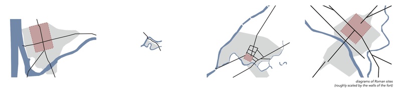
Diagrams of Roman Chester, Walton-le-Dale, Manchester and York
The research about typology of Roman town planning has been carried out by investigating four specific sites. Based on the historic maps and articles, the relation between Roman town, roads and waterways was described in these diagrams.
Posted 24 Oct 2021 22:43
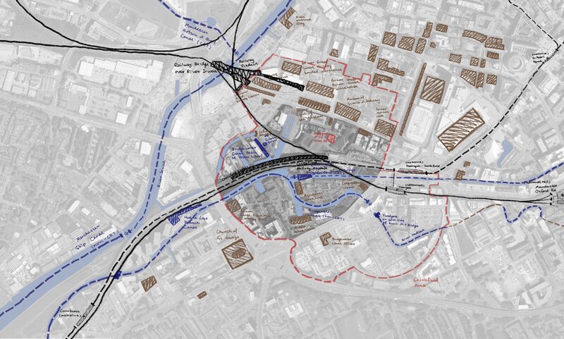
Sketched map showing various layers in Castlefield
To further understand about the context, we started our research from the existed layers in Castlefield, including waterways, railways and listed buildings. Through the context research, the situation of redevelopment or renovation within Castlefield have been clarified. Because of the "unreliable" reconstruction, the embarrassed position of the Roman heritage has become more and more obvious.
Posted 24 Oct 2021 22:42
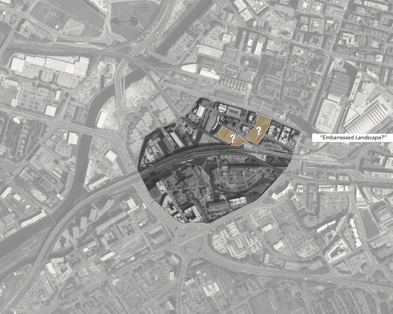
The map with highlights showing the initial interest
When wandering around Castlefield this summer, both of us took particular attention to the Roman Fort reconstruction in this area. As one of the most important heritages, this Roman heritage, to some extent, was under an "embarrassed" position. People just pass by, go jogging or take the dog for a walk. Few people truly stop to visit and understand about the Roman heritage. Due to the historic value, it keeps as ever. It is, to some extent, lying vacant and a little bit desolated. We believe it could contribute more and engage more in Castlefield, the surrounding context. So we would regard it as a starting point for our further exploration.
Posted 24 Oct 2021 22:40